Kupe’s Sails

kupes labelled

Robert Jenkin wrote:

After reading the 2007 New Zealand Book Award History  prize-winning book Vaka Moana (2006, K.Howe ed.) and Atholl Anderson’s chapters of the 2015 Royal Society of New Zealand Science Book prize-winning book Tangata Whenua I think I understand that stages in the evolution of the shunting oceanic-lateen were first the double-sprit, next the oceanic-sprit, next and crucially the prop-masted oceanic-lateen, as used by Tonga in her ‘imperial’ period, which may have reached the Cook Islands from Tonga in or before the 11th century, and finally the shunting oceanic-lateen. This is the ‘flyer’ type, which so impressed visiting Europeans, first Magellan in Guam in 1521,  then the Dutch in Batavia Java, in the 17th century and later the English and the French in northeast Polynesia in the 18th century. The shunting oceanic-lateen arguably out-performed any other sailing rig in the world, but in order to tack by ‘shunting’, waka that used it needed to be double-ended.
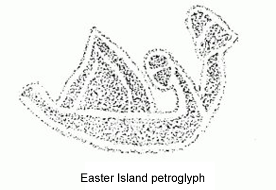
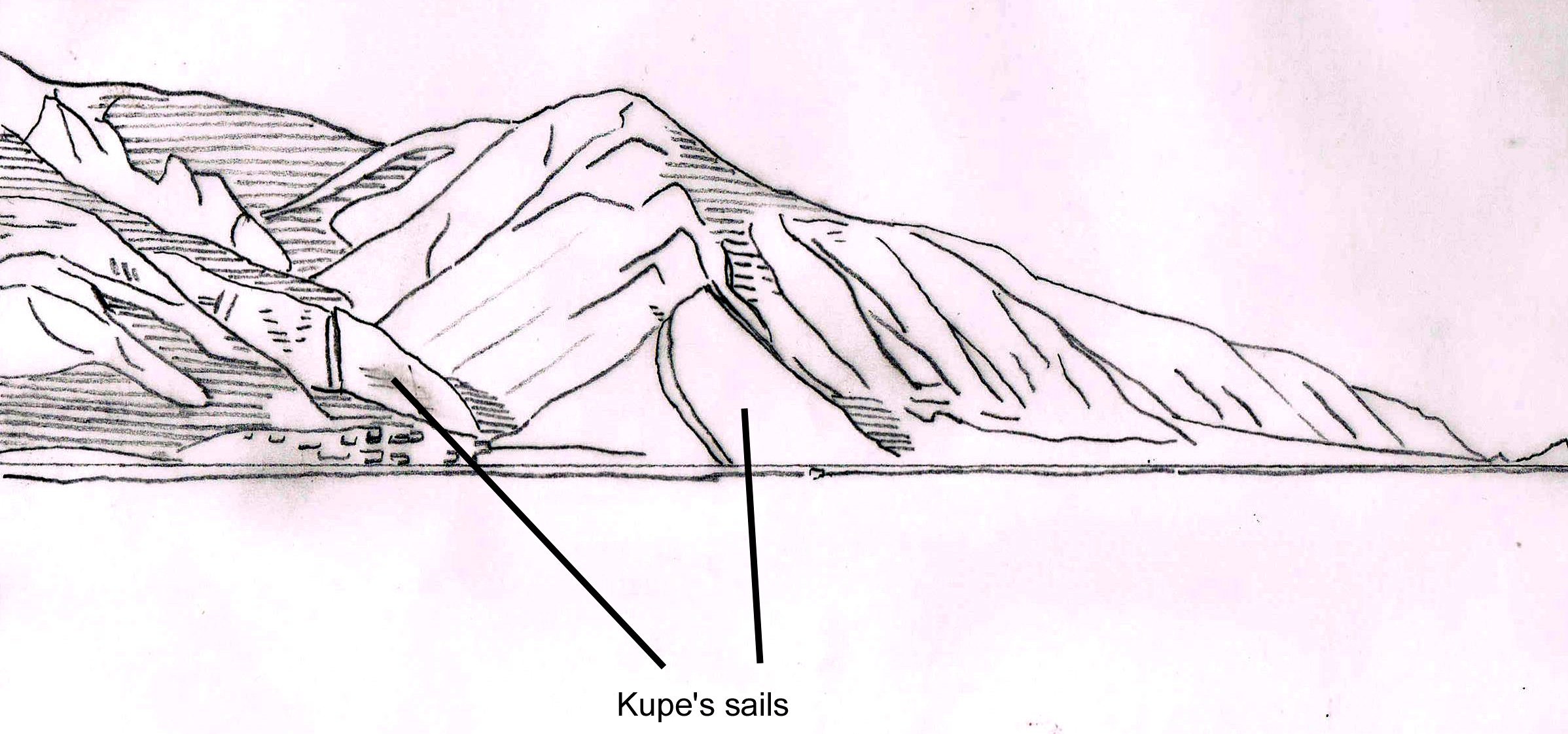
petroglyphIn order to to make return trips to South America, Easter Island, Hawaii and Aotearoa,  East Polynesian voyaging waka had to sail fast, at least with and across the wind. The sail used on some of the voyaging canoes that came here in the thirteenth century could possibly have been the prop-masted oceanic-lateen, as indicated by the Wairarapa coast landforms called Kupe’s sails and also by an Easter Island petroglyph. This was also the sail first seen by Europeans on an open ocean voyaging canoe. The Schouten and le Maire expedition sighted, captured and eventually released a Tongan double hulled voyaging canoe with a complement of about 25 possibly on its way from Tonga to Samoa in 1616. Tonga and Samoa may have first developed prop-masted lateen sails centuries before, perhaps even before the 11th century. In that case East Polynesians would very possibly also have acquired them, perhaps through the Cook Islands, and used them in the the 12th and 13th centuries for their far-ranging trans-Pacific voyages.

Continue reading

Posted in Uncategorized | 2 Comments

The acquisitive gaze – colonialism and post-colonialism

Robert Jenkin wrote:

Can present day New Zealanders, descendants of the colonisers and the colonised,  construct a post-colonial and more bi-cultural view of  our shared history; can we assess the story of the first recorded meeting between Maori and Europeans post-colonially? One major problem is that every single contemporary text we so far have to use in doing so was written down or drawn or charted by a European.

Continue reading

Posted in Uncategorized | Leave a comment

The Mysterious Eastland Revealed

Michael Ross has kindly agreed to our adding his article The Mysterious Eastland Revealed (The Globe #53 (2002), Ross, M, ‘The mysterious Eastland revealed’, p.1-22.) as another Tasman related ‘resource’ on this site. It was an internationally peer reviewed paper that won the Estelle Canning prize on presentation.


Posted in Uncategorized | Comments Off on The Mysterious Eastland Revealed

Is there stylistic evidence of more than one SAC illustration copyist

Robert Jenkin wrote:

Till very recently I speculated that some of the later SAC illustrations, including ‘people of Island Moa Iamna and other surrounding islands’ and ‘Thus appears the vessel of Noua Guinea and people dwelling therein’ might have been the work of a different draughtsman/copyist. I thought I saw in them a somewhat tidier, less sketchy style.

But now, on close examination of details such as those I’ve pasted in below, I’m coming to the view that all the large composite illustrations were created and copied by one man.

Continue reading

Posted in Uncategorized | 4 Comments

Was Gilsemans really Tasman’s primary draughtsman?

Who was the expedition’s primary draughtsman, and was there more than one? Some commentators have attributed ‘A View of Murderers’ Bay’ to Isaac Gilsemans.

On August 1st 1642 Gilsemans was described as having “fair knowledge of seafaring, and the drawing of lands”; however he may not have been the only senior officer with these abilities, and in my view was unlikely to be the man specifically appointed as draughtsman.

Continue reading

Posted in Uncategorized | Leave a comment

Wharawharangi Beach

One interesting point which Mack’s sketch map of Wainui Bay and Wharawharangi beach draws attention to is that the first likely ‘watering place’ the small boats would have seen was at Wharawharangi Beach. Why would they go straight past it, heading instead to Taupo Point where there is only a very minor stream, one they could not have seen at all unless they got quite close, and then to Abel Tasman Point, where there is no stream to speak of at all? Wouldn’t they have tried Wharawharangi first?

watering place

Wharawharangi beach, where a sizeable creek forms a fresh water lagoon behind the sand at center right.

Could it have been that waka hunua (double hulled ocean going canoes) were already present on or near this beach on the 18th, manned possibly by a large taua (group of warriors) who had used this as a stopoff as they traveled between Te Ika a Maui (The North Island, where Maori populations were largest) and Te Wai Pounamu (the West coat of the South Island) where highly valued greenstone could be found.

Continue reading

Posted in Uncategorized | 3 Comments

Witsen’s other images

In the Bulletin of the Australasian Institute for Maritime Archaeology (2014), 38, A possible pre-Tasman canoe landing site, or tauranga waka, in Golden Bay, South Island, New Zealand (2014), Mack and Hawarden state that “Witsen (1705: 172) includes four images of the Tongan and New Guinea coast lines from Abel Tasman’s 1642–43 expedition, all of which differ from the illustrations of the same areas in the official Abel Tasman journal (Sharp 1968: 160–161, 166–167, 217, 245). An investigation comparing the Witsen illustrations of Tonga and New Guinea with the illustrations in the official journal may prove useful. If these other Witsen images of Tonga and New Guinea can be accurately correlated to the landscape, historians and archaeologists will gain an improved understanding of the conditions prevailing in this important contact period.”

Continue reading

Posted in Uncategorized | 15 Comments

Mack’s labelling of Witsen

Wainui images compared copy


Posted in Uncategorized | 2 Comments

Historical illustrations as a source of written history

Contemporary illustrations of past events can and do complement written history, and much may yet be learned, as Patricia Wallace has shown in her 2006 article ‘Traditional Maori Dress: Recovery of a Seventeenth–Century Style?’, from illustrations that appear in the State Archives Copy (SAC) of Tasman’s Journal.

As Andrew Sharp explains in The Voyages of Abel Janszoon Tasman, the SAC, which still bears Tasman’s signature, is likely to have been one of several “day registers of the aforesaid Tasman” that were consigned to the Netherlands from Batavia and mentioned in a V.O.C. report dated 22 Dec.1643. Sharp further comments that the SAC illustrations were “evidently drawn in in spaces left for them in the text” and that our two surviving journal texts, SAC and Huydercoper, are “independent copies of the same [now lost] original journal”.

We therefore have sound provenance for SAC; we know its charts and illustrations were produced by  V.O.C. employees in Batavia in 1643, and may presume they were derived  from originals created on Tasman’s 1642-1643  expedition, since he himself authenticated them by signing them.

Problems may well occur if later illustrations that apparently derive from SAC are thought to be a source of further data not contained in the originals, and so a valid basis for new written history. Such problems plague an article by Rudiger Mack,  ‘Did Dutch Sailors land in Wainui Bay on 18 December 1642: The First Printed Illustration of New Zealand’ ( 2004 Turnbull Library Record (TLR) 37, 2004) which seeks to overturn existing Tasman history on the authority of Vaertuig en Gedaente der inwoonders van Selandia Nova (Vessel and appearance of the inhabitants of New Zealand’), a plate commissioned by Nicholas Witsen to illustrate his 1705 work Noord en Oost Tartarije.

Continue reading

Posted in Uncategorized | 1 Comment

Confirming Anderson’s location of Tasman’s D’Urville anchorage

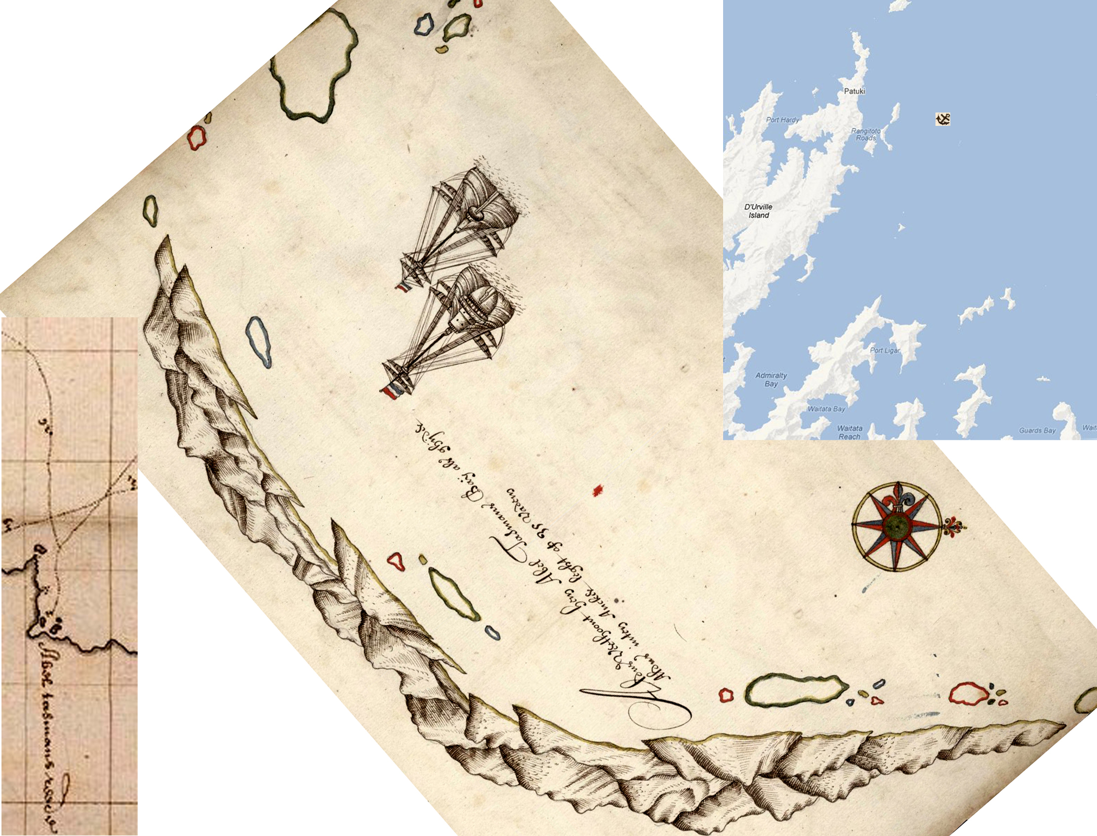
In The Voyages of Abel Janszoon Tasman, 1968, Andrew Sharp did not attempted to exactly locate Tasman’s 1642 anchorage between Dec 21st and 26th. Instead he cautiously observed: “It is difficult to relate the positions in the drawing … and the chart … to each other or to the precise topography of the area, or to identify the rocks behind which they anchored with Stephens Island NNW. The anchorage cannot be pinpointed, but was somewhere east of D’Urville Island.

f066--dUrville IdIt is indeed hard to to relate the positions in the drawing (above)and the chart (below) to each other or to the precise topography of the area, because the chart seems to place the D’Urville anchorage about half a degree south of the Golden Bay anchorage, a distance of some 50km.

anchorages Tasman's mapSince Sharp published in 1968 more has been learned. In 1991 Grahame Anderson published an article: ‘Tasman revalued, a note on Gilsemans’ drawings’. Anderson was more confident than Sharp, and having visited the area in 1985 on an 11 metre yacht he wrote “Within a few minutes of arriving at what we thought might be the right place, using Tasman’s bearings to Stephens island and his depth at the anchorage as primary guidelines, we found to our surprise and delight that we had pin-pointed their position to within 50 metre. Gilsemans’ drawing was a precise cartographic document, with every island, headland and hilltop in exactly the right place, and its curved coastline encompassed the whole of the top of the Marlborough Sounds from Cape Jackson in the east to Cape Stephens in the west.

Christmas anchorage 1642To understand the drawing in the way Anderson does its helpful to align it with a  map.

Anderson anchorageIt’s also helpful to reject Sharp’s translators phrase “let our anchor fall there behind some rocks” in favour of Heeres’ translation: “then dropped our anchor behind a number of cliffs in 33 fathom, sandy ground mixed with shells. There are many islands and cliffs all round here.”

Now, having photographed the area myself from a point just a little closer than Anderson’s to the shelter of Rangitoto Islands numerous cliffs, I can confirm that his location, or one close to it, makes the best sense of all the different strands of evidence:

pan 2 labelledWhile cloud concealed many of the higher features Anderson identifies, I have found Google Earth 3d a helpful tool, as it allows the user to zoom in on every feature Anderson identifies, viewing them all from different altitudes as necessary and so ensuring the  topography is accurately understood.

google pan labelledThe Google Earth derived image above is taken from the anchorage location as established by Anderson (2001, p.98), whereas the photo panorama above it is from a rather more sheltered position somewhat closer to the cliffs of Rangitoto Islands. The panorama below is from a position even further out than Grahame’s, but all three are on a line between Mount Pascoe and Jag Rocks. Both photo panoramas are taken with a depth of around 50 metres, which I regard as more compatible with the 1.7 metre fathom Hoving states was used by Dutch in 1642.

Pan 5


Posted in Uncategorized | 1 Comment